Sample property report
The report tool turns a tax parcel you pick on the map into a PDF about its terrain, measured inside the parcel boundary. This one was made for a 50.94-acre rural parcel in Greene County (SWIS tax map ID 19440075.00-1-2.1): elevation 1,427–1,935 ft, mean slope 10.1°, 8 h 1 min of winter sun. Nothing was edited after the tool produced it.
The pages
11 US Letter pages. After the cover, the report has these pages:
- At a glance
- Elevation and contours
- Slope
- Aspect
- Winter sun
- Drainage
- Hillshade and statistics
- Before you commit
- Data and accuracy
Every page
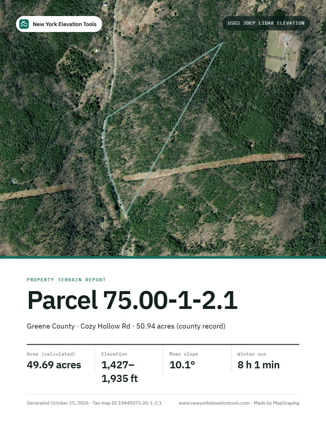
01 Cover
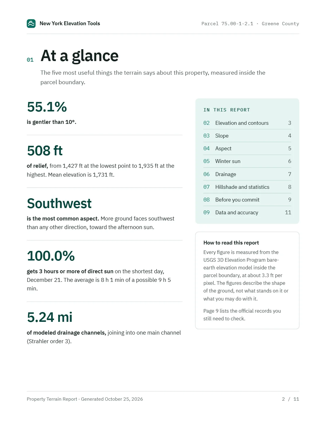
02 At a glance
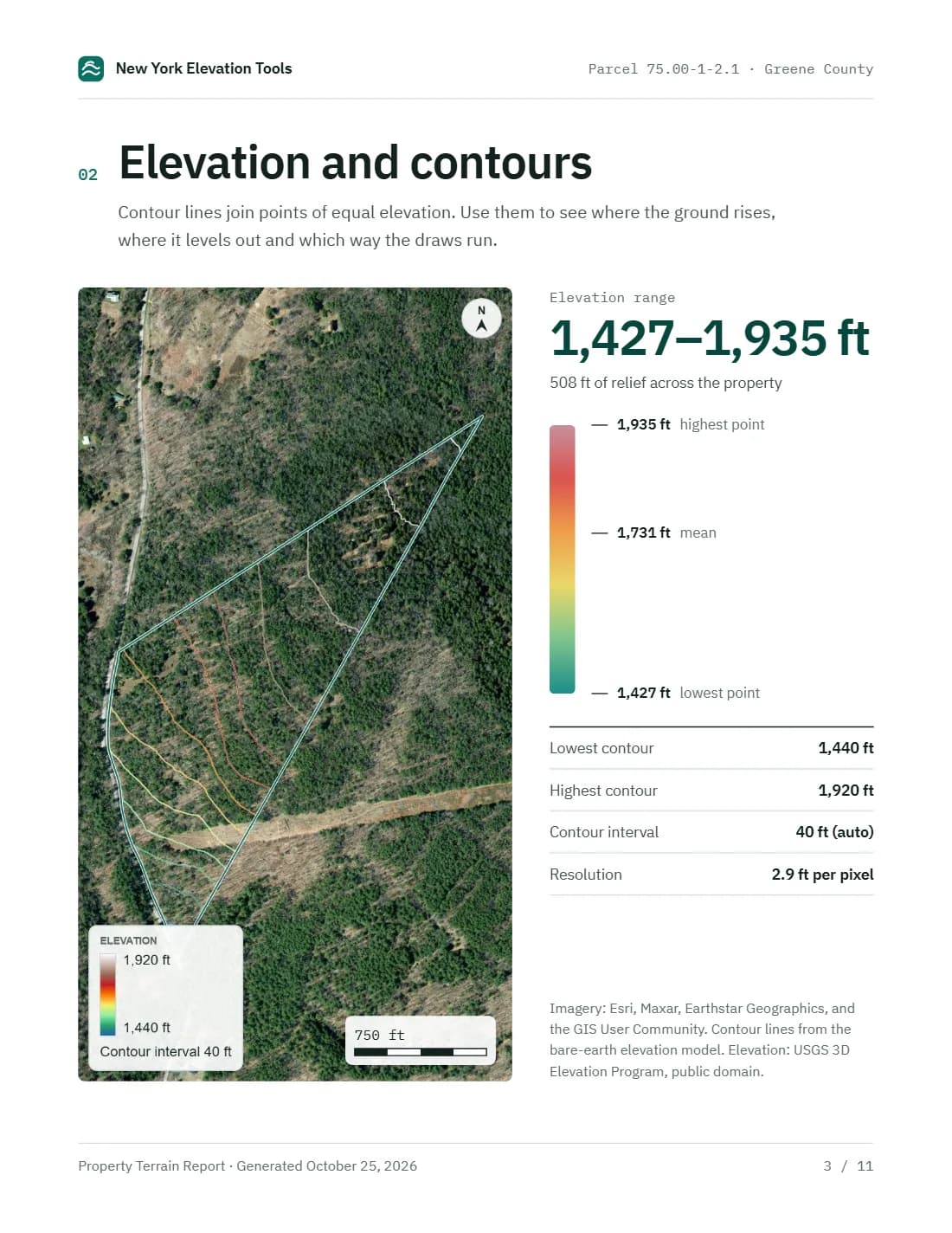
03 Elevation and contours

04 Slope
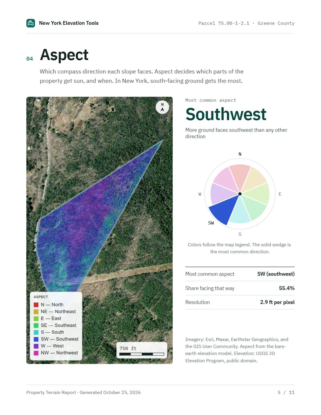
05 Aspect
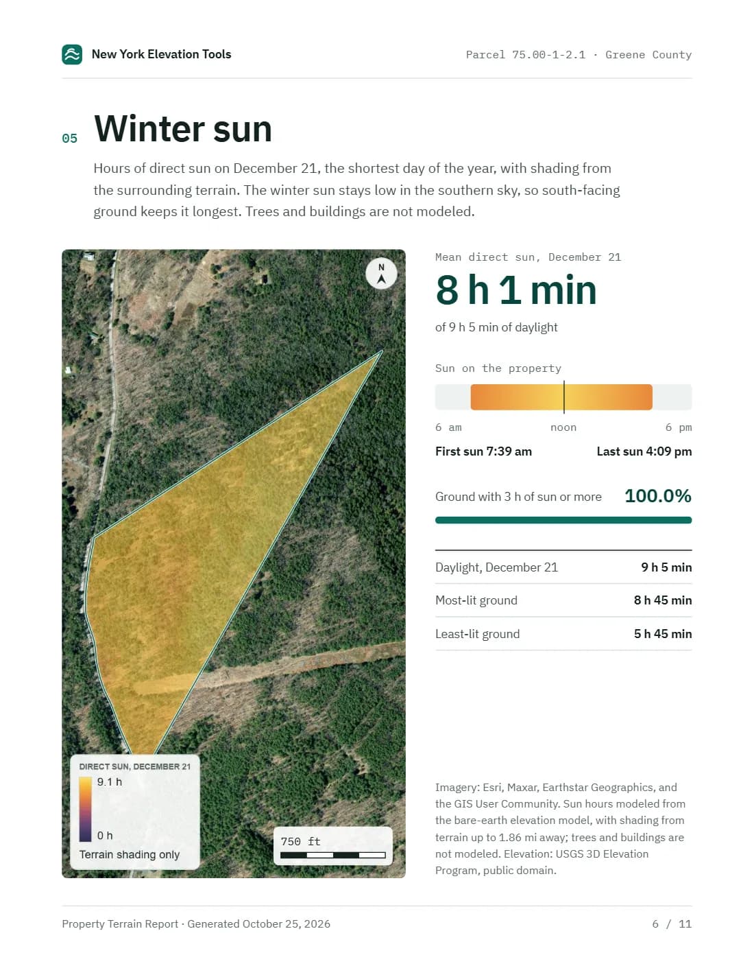
06 Winter sun
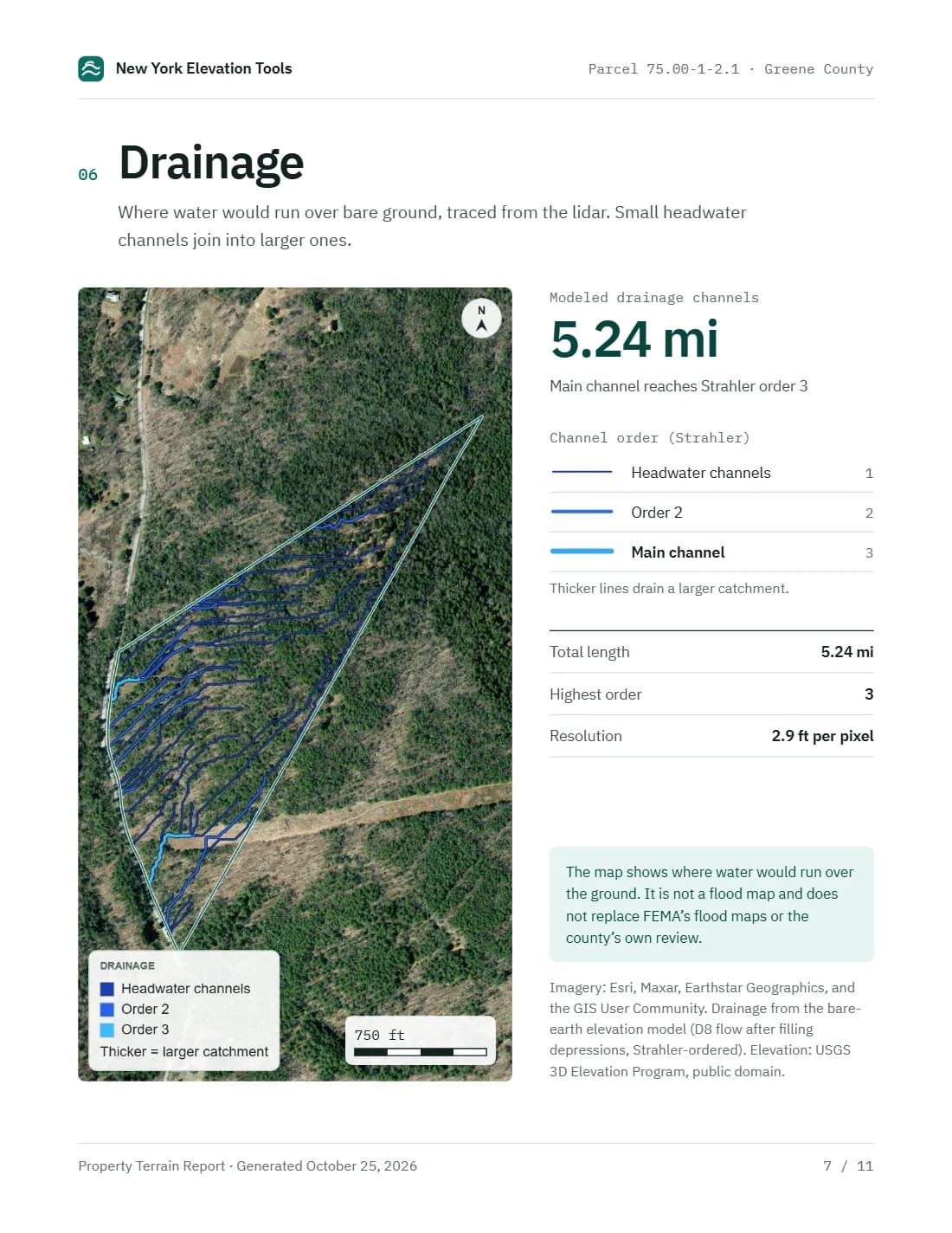
07 Drainage
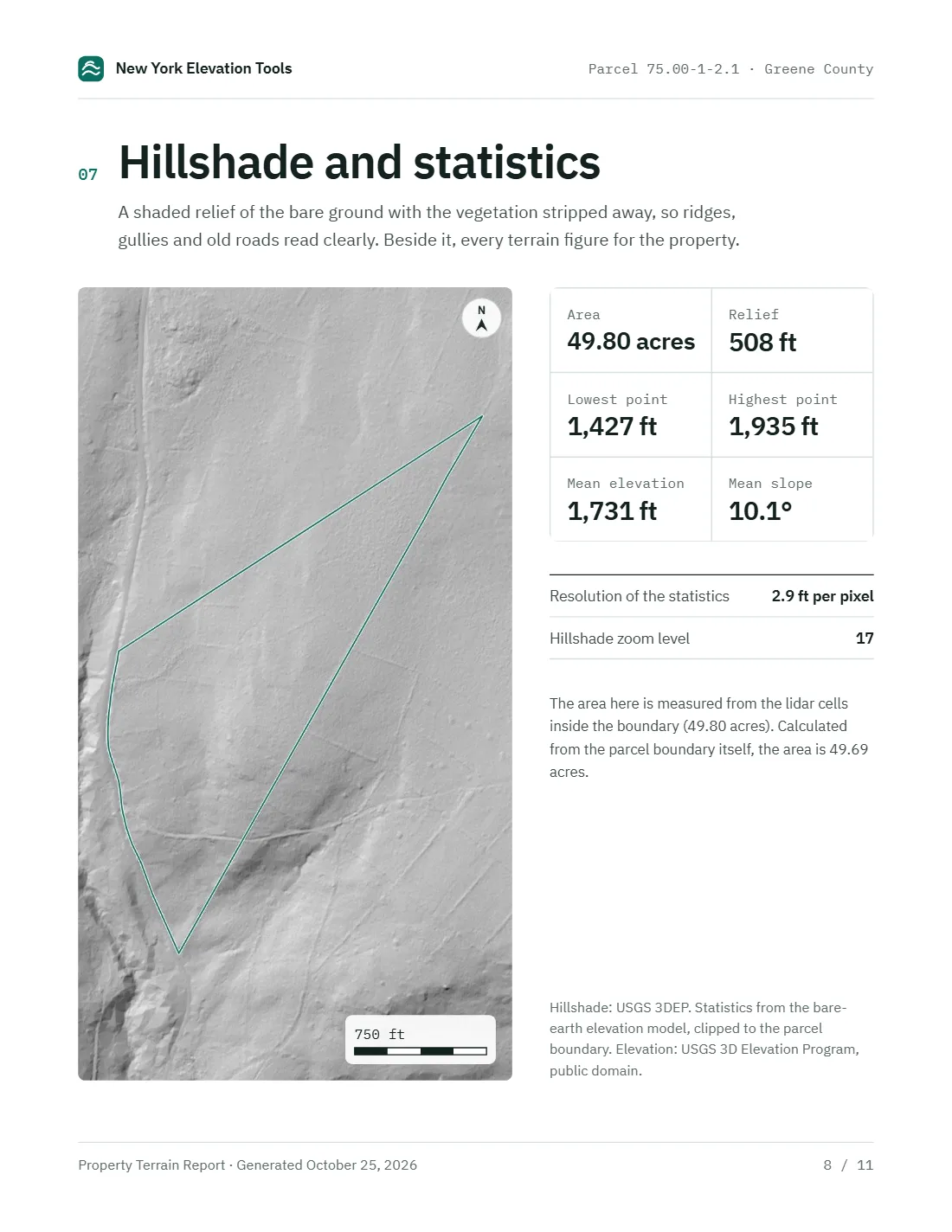
08 Hillshade and statistics
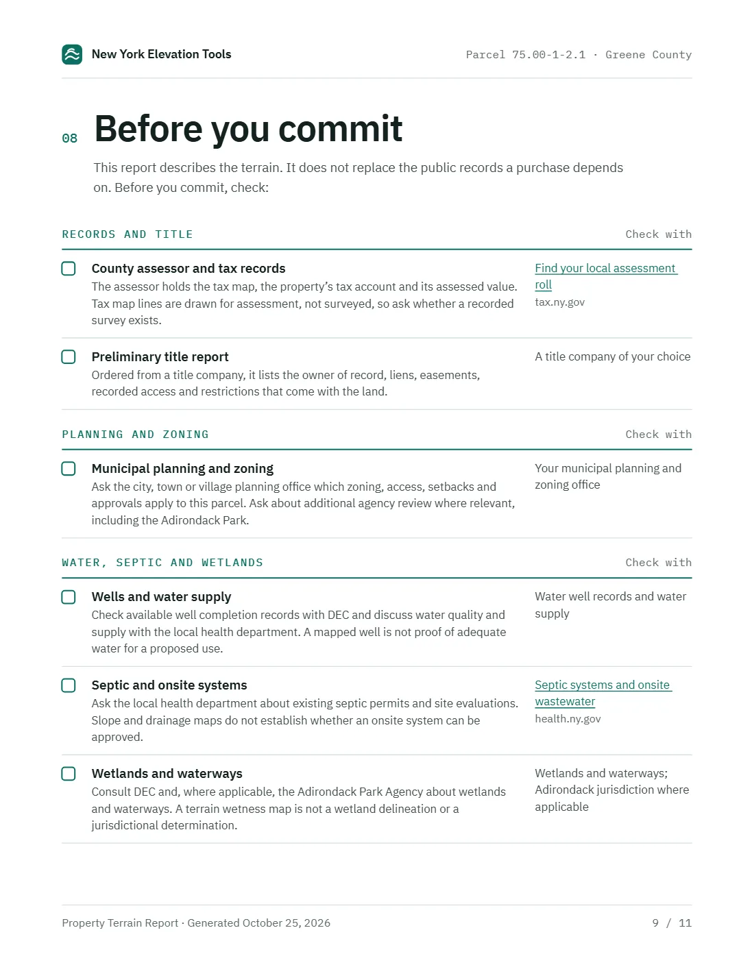
09 Before you commit
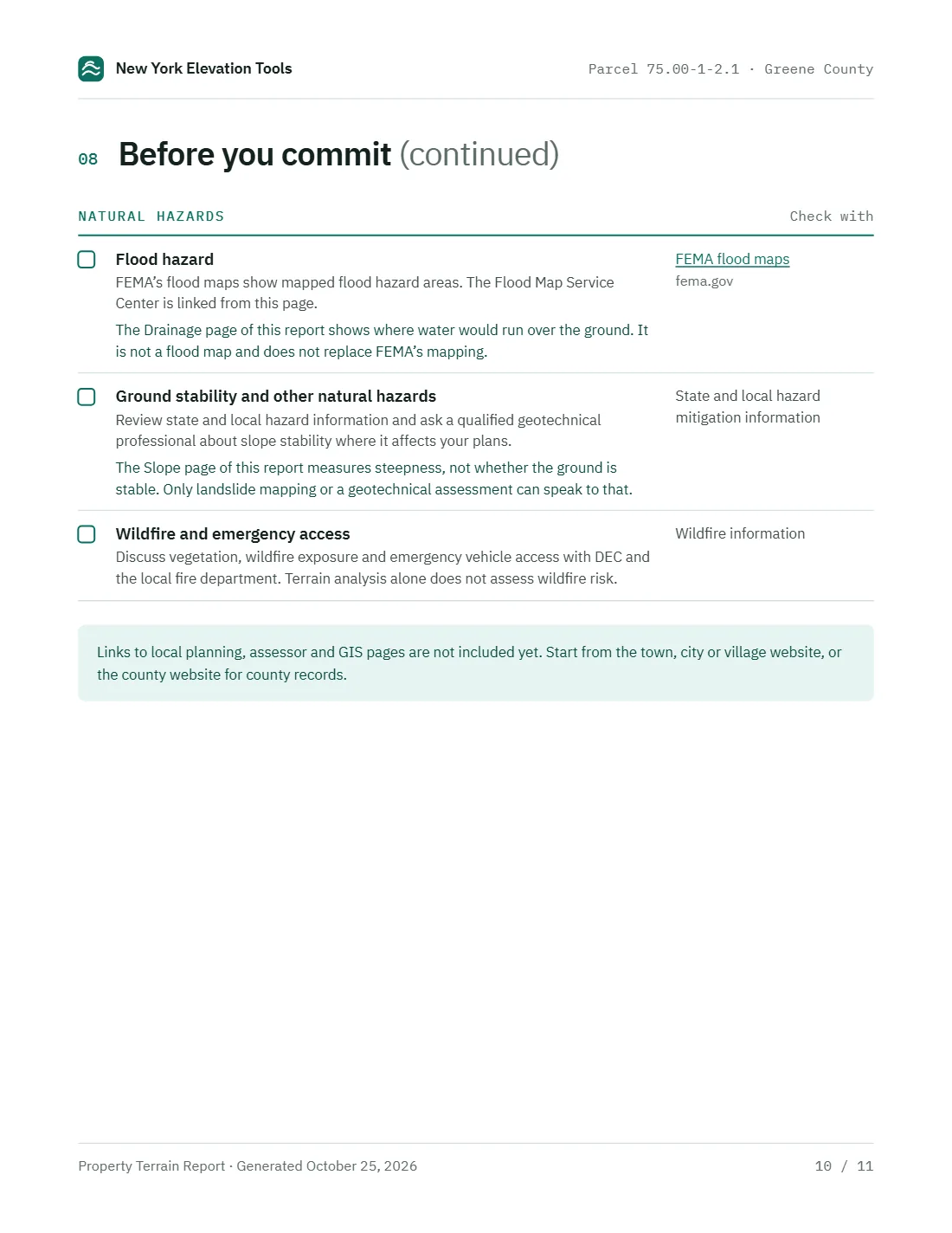
10 Before you commit (continued)
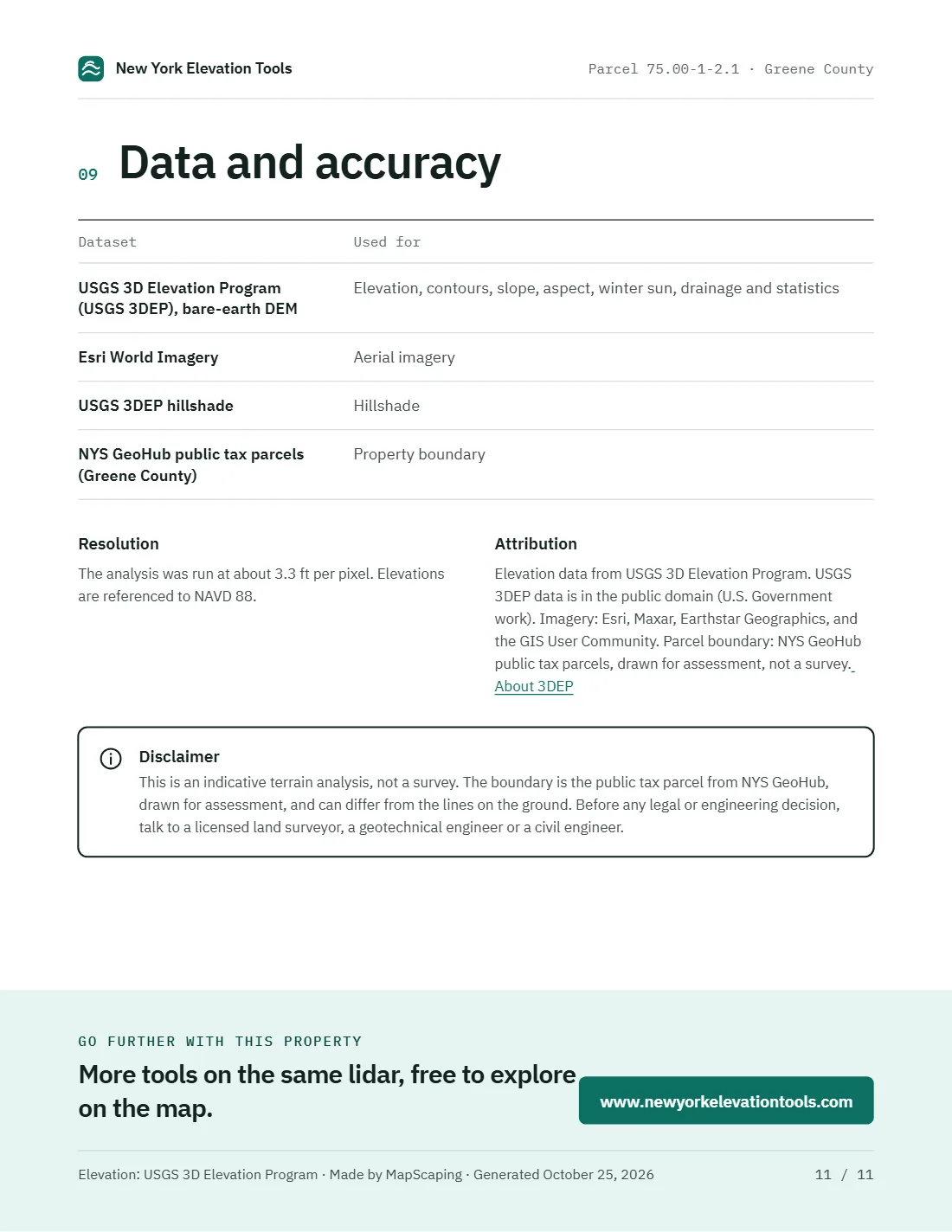
11 Data and accuracy