USGS 3DEP lidar for surveyors and GIS analysts, cut to your site
Get the New York lidar DEM for GIS work without downloading and merging raw tiles: draw or select the area, and the tools read the USGS 3DEP elevation model for exactly that extent and return a GeoTIFF, contours, terrain statistics or drainage lines.
Use it for desk studies, quick checks against a survey, and the first look at a site before you send a crew out. Every result states what share of the area fell outside lidar at 3.3 ft per pixel.
The workflow
Step 1 · Download Data
A DEM and an aerial photo for the site
The 3DEP elevation model as a GeoTIFF above NAVD 88, covering the rectangle around your area or property. Values in the file are in meters, as USGS publishes them. The same tool delivers a georeferenced color aerial photo from USGS NAIP (public domain), about 1 ft per pixel where available, as a JPEG with a world file in Web Mercator, to sit under the DEM and contours.
Step 2 · Contour Lines
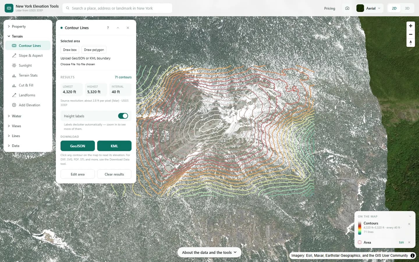
Contours in your format
Contours at any interval from 1 ft, as Shapefile, GeoJSON, KML, or DXF in New York State Plane feet.
Step 3 · Terrain Stats
Terrain statistics
Minimum, maximum, mean and range of elevation, with the elevation distribution.
Step 4 · Water & Drainage
Drainage network
Channels ranked by stream order and ponding areas, exported as GeoJSON or KML.
Step 5 · Elevate a File
Elevations for your points
Ground elevation added to a CSV, GPX, KML or GeoJSON of your own points.
Free to run · pay to download
See the full result on the map free, with no account. Download the DEM as GeoTIFF, contours as Shapefile, GeoJSON, KML or DXF, a georeferenced aerial photo, drainage lines as GeoJSON or KML, and your enriched files with a pass: US$29 for 24 hours, US$99 for 30 days or US$399 for 12 months, a one-off payment in US dollars that never renews. Every download on the site is included while the pass lasts.
What it doesn’t replace
- The DEM is the USGS 3DEP seamless model: 3.3 ft per pixel where lidar has been flown, about 33 ft per pixel elsewhere. It is not survey grade, and its accuracy is that of the lidar project behind it.
- Exports are capped in size, so large areas are resampled. The National Map has the same public-domain data as raw tiles for larger areas.
- Bare earth only. A statewide surface model is not connected; tree and roof heights are unavailable.
Questions
Which coordinate systems do the files use?
The GeoTIFF is in WGS 84 latitude and longitude (EPSG:4326), above NAVD 88; its values are in meters, as USGS publishes them. The DXF is in New York State Plane, US survey feet (zone recorded in the file), with elevations in feet. GeoJSON, KML and Shapefile contours are in WGS 84, with each line’s elevation in feet and a meters field alongside.
Where can I see which lidar project covers my site?
The lidar coverage checker lists USGS work units at a point, with collection year, source resolution and quality level where available.
Can several people use one pass?
A pass lives in the browser it was bought in, with no account. Anyone can run the tools for free; downloads work in the browser that holds the pass.
Guides
Data
Everything runs on the USGS 3D Elevation Program (3DEP) bare-earth elevation model: lidar at 3.3 ft per pixel where it has been flown, and the 1/3 arc-second model, about 33 ft per pixel, elsewhere. Every result says how much of the area came from that coarser model.
USGS 3DEP elevation and USGS maps are U.S. Government works in the public domain. Credit the USGS 3D Elevation Program. NYS public tax parcels are assessment data provided as is, not surveys. Esri World Imagery follows its own terms and is display-only; downloaded aerial imagery comes from USGS NAIP. Sample image: Elevation data from USGS 3D Elevation Program. USGS 3DEP data is in the public domain (U.S. Government work).