Data · Click a point
Historical aerial photos of any New York spot, then and now
See historical aerial photos of any spot in New York: click the map and step through every year NYS ITS Geospatial Services holds for it, oldest first, 2000 to 2025.
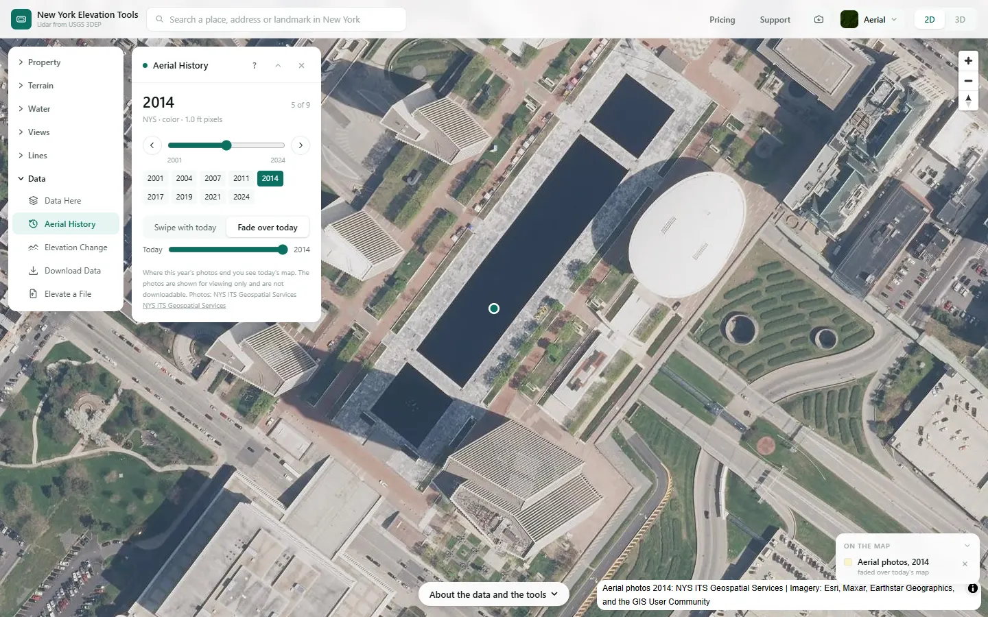
Drag a divider across the map to compare any year with today, or fade the old photo over the current one. Each photo is credited on the map as its source credits itself.
Free to run · pay to download
Free to run, and free to save as a PNG image of the map. This tool has no file export of its own. For the terrain as a file, Download Data exports contours, a GeoTIFF or a 3D mesh with a pass: US$29 for 24 hours, US$99 for 30 days or US$399 for 12 months.
Who uses this
- Buyers and owners. See what was there before: old roads, buildings since removed, cleared or replanted ground.
- Planners and consultants. Check past land use at a site before ordering records.
- Family and local historians. Find the farm, street or river bend as it looked decades ago.
When to use it
- You want to see what a property looked like before it was cleared, built on, logged or planted.
- You are looking for old roads, filled ditches, former buildings or a stream that has moved.
- You want to see how a river bank, a gravel bar or a stretch of coast has changed since 2000.
Tools for your job
Aerial History is one step in a bigger question. These are the jobs it helps with, and the tools that go with it.
For the job: Buying a lot or rural acreage
What is the ground like, and how does it compare with the others on my list?
- 1.Property — Selects the tax parcel so every other tool is clipped to the boundary.
- 2.Property Report — A PDF with contours, slope, aspect, winter sun, drainage and elevation for that parcel, or several selected together.
- 3.Saved Properties — Up to 5 places side by side: elevation, slope, winter sun and drainage.
- 4.Water & Drainage — Where water will run and pond across the property in heavy rain.
- 5.Aerial History (this tool) — Aerial photos of the spot from 2000 on, swiped against today: old roads, buildings and clearings.
How to use it
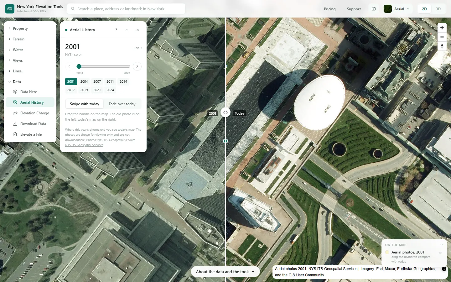
- Open Aerial History and click a spot. The oldest photo of it appears on the map, with today’s map on the right of a divider.
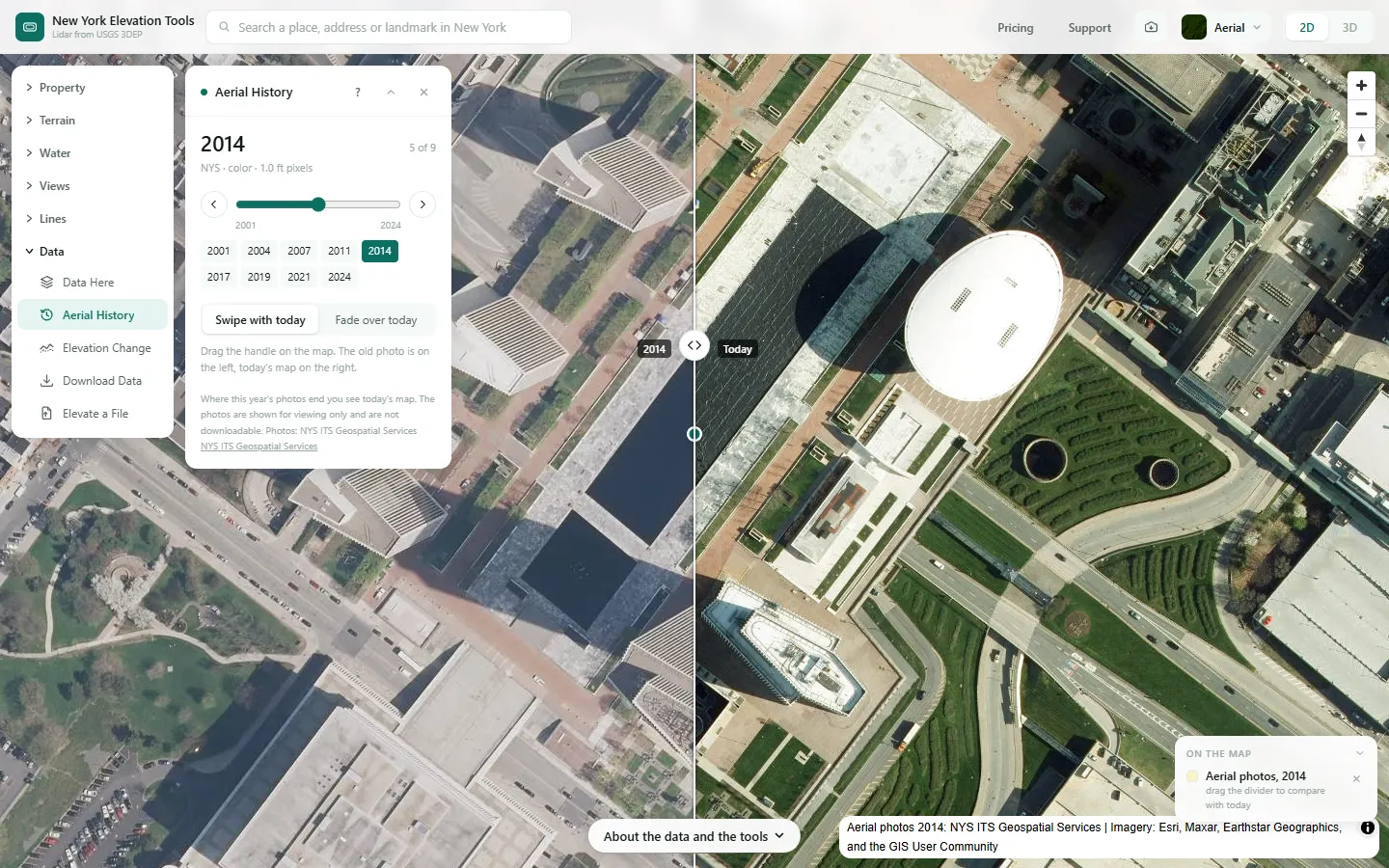
- Drag the divider handle across the map to compare. Use the slider, the arrows or the year buttons to move through the years.
- Choose Fade over today to lay the photo over the whole map and set how see-through it is.
- Data Here lists the same years for a spot, with a button that opens them here.
Step by step: an Albany lot
We look back at an Albany lot through the years of aerial photos the state’s orthoimagery server holds for it.
What it showed
- Old photos show what the ground was before it was built on: former fields, tracks and buildings since removed.
- The photos are for viewing on the map only; they are not downloadable and stay out of Save image.
Screenshots from New York Elevation Tools. Imagery: Esri, Maxar, Earthstar Geographics, and the GIS User Community. Elevation data from USGS 3D Elevation Program. USGS 3DEP data is in the public domain (U.S. Government work).
How it works
The photos come from NYS ITS Geospatial Services’s orthoimagery server, which holds 26 years: 2000, 2001, 2002, 2003, 2004, 2005, 2006, 2007, 2008, 2009, 2010, 2011, 2012, 2013, 2014, 2015, 2016, 2017, 2018, 2019, 2020, 2021, 2022, 2023, 2024, 2025. The state flies about a third of New York each spring, so each of its years covers part of the state; NAIP 2019 (the USDA’s National Agriculture Imagery Program, flown in late summer) covers all of it.
When you click, the site asks each year’s photos whether they reach that spot, and lists only the years that do.
Stated resolutions run from about 1.0 ft to about 2.0 ft; the panel shows each year’s where its service states one (2001, 2002, 2003, 2004, 2005 do not).
The 2000, 2001, 2002, 2004, 2005 services include black-and-white (panchromatic) photos in some areas, as they describe themselves; the panel says so for those years.
Reading the results
Years are the years the service is named for. Neighboring parts of one year’s photos can have been flown on different days of that season.
Where a year’s photos end you see today’s map, not the old photo.
Each photo is credited on the map and in the panel as its service credits itself.
Limits and caveats
- The photos are shown for viewing only and are not downloadable. They are left out of the map’s Save image, and the property report does not include them.
- Coarser years blur when you zoom in close: the map enlarges their last tiles rather than showing more detail.
- If NYS ITS Geospatial Services does not answer, the panel says so; click the spot again in a minute.
Data and attribution
Photos: NYS ITS Geospatial Services’s imagery server (2000, 2001, 2002, 2003, 2004, 2005, 2006, 2007, 2008, 2009, 2010, 2011, 2012, 2013, 2014, 2015, 2016, 2017, 2018, 2019, 2020, 2021, 2022, 2023, 2024, 2025), each year credited as its service credits itself. The services carry only an “as is” disclaimer and state no license, so the site shows them on the map only.
USGS 3DEP elevation and USGS maps are U.S. Government works in the public domain. Credit the USGS 3D Elevation Program. NYS public tax parcels are assessment data provided as is, not surveys. Esri World Imagery follows its own terms and is display-only; downloaded aerial imagery comes from USGS NAIP.
Questions
How far back do the photos go?
To 2000. NYS ITS Geospatial Services serves 26 years: 2000, 2001, 2002, 2003, 2004, 2005, 2006, 2007, 2008, 2009, 2010, 2011, 2012, 2013, 2014, 2015, 2016, 2017, 2018, 2019, 2020, 2021, 2022, 2023, 2024, 2025. The state flies about a third of New York each spring, so each year covers part of the state and the panel lists only the years with a photo at the spot you click.
Can I download the photos?
No. The photos are shown on the map for viewing only and are not downloadable here; they are also left out of Save image and of the property report.
Ready to try it?
Open Aerial History on the map →Free to use, no account. The analysis runs in your browser on public-domain USGS 3DEP data. Downloading the results needs a pass: see pricing.
Missing something you need? Suggest a feature or ask about custom work.